Geography
Apollonia was located on the right bank of the Aous River (the modern-day Vjose River). Its ruins are situated in the Fier region, near the village of Pojani.
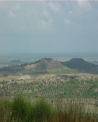
The Greek settlement was built upon two hills, called 101 and 104 after their elevations above the sea level. On hill 101 was most probably situated the Acropolis. The side of the city towards the coast contains the most visible monuments, grouped in the Agora. The surface of the city at his most flourishing moment was around 130ha. The area of the necropoleis was about 50ha. The walled town is about 80 ha.
There is a lack of information from both ancient sources and modern research about the size and extent of the Apollonia chora.
Its morphological situation has considerably changed since the classical period. The wide and large plain that connects Apollonia to the sea on the western side was at that time covered by sea or lagoon with a direct connection with the sea through channels. Its position was very strategic since it is at the end of the valley of Vjosa, one of the most important natural routes towards inland. It was most probably because of the alluvial deposits that were brought by Vjosa that the town lost its relation with sea (nowadays the coast is far about km 10) and declined during late Roman period, leaving the role of primary port to Dyrrhachium.
Geophysical and topographic surveys made between the two citadels of the city showed the existence of three residential areas forming narrow islands separated by stenopoi and dating back to the Archaic period. During the Hellenistic period, a large rectangular public square was located at the foot of a hill, partly destroying the old neighborhoods. The square was bordered to the north by a portico over 120 meters long of which remain only the foundations and some architectural decoration that escaped the complete dismantling of the monument in the second or third century AD.