
Geography
The ruins are situated in a spectacular location just south of the village of Saraqinish, Gjirokaster District,opposite Gjirokaster. The ruins are accessible from Gjirokaster by car or by hiking trail. From the main square in Asim Zeneli, a sing posted hiking trail leads to the Park in about 2 hours.
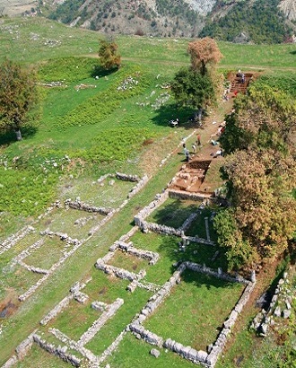
Antigonea lies on a hill about 600 meters above sea level and was at one point completely encircled by a fortified wall estimated at four kilometers in circumference, with the city's spread covering 35 hectares.
It has an important geographic position at a dominant point on the hill of Jerma, in the middle of the Drinos Valley and controlled the famous Via Egnatia, connecting Dyrrachium (Durres), Apollonia and Oricum with the highlands of of Ioannina and Southern Epirus.